

One app for your maps, your tracking and your safety
Not just an offline map, and not just an activity tracker — ZhuiZhui bundles everything Taiwan's hikers and trail runners actually need into one app that works without the internet.
Offline Maps & Trail Database
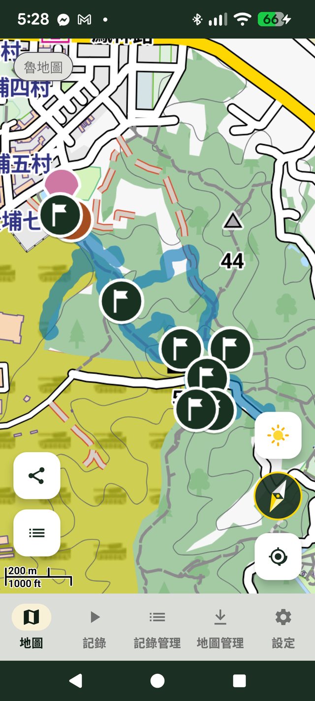
Download Taiwan's LuMap and overseas map data with no internet required. Built-in POI database of peaks, triangulation points, huts and water sources — works with zero signal.
Explore offline maps →Run & Hike Dual-Mode Tracking
Real-time distance, elevation gain/loss and pace, auto-pause that keeps data accurate, and an automatic elevation profile and pace chart when you finish.
See tracking features →Live Group Sharing|Built for Your Emergency Contact
Create or join a group and see everyone's live location; share your personal hiking location with your emergency contact or family — no install, no sign-in required to view.
See group sharing →Local Weather & Tides
Real-time rainfall forecasts, a 3-day weather outlook, and nearby tide station data — get the full picture before you head out.
See weather features →GPX / KML / KMZ Import, GPX Export
Import existing tracks to overlay and compare; export your own recorded routes as GPX. Your data stays yours — never locked into one platform.
See data export →Color-Blind-Friendly Design
Maps and charts use the Okabe-Ito color-blind-friendly palette, so every user can clearly tell routes and legends apart.
About this design →Trail Closure Info
Integrates open data from Taiwan's Forestry and Nature Conservation Agency — check trail closures, partial closures and expected reopening dates before you head out.
See the trail database →Built-in Compass
A compass built right into the map shows your current heading and GPS accuracy in real time — no need for a separate compass in the mountains.
Explore offline maps →Off-Route & Inactivity Alerts
Straying from a loaded reference route triggers a sound and vibration alert; if a group or shared member hasn't moved for over 6 hours, your emergency contact sees a clear warning online.
See tracking features →From offline maps to live sharing, all in one app
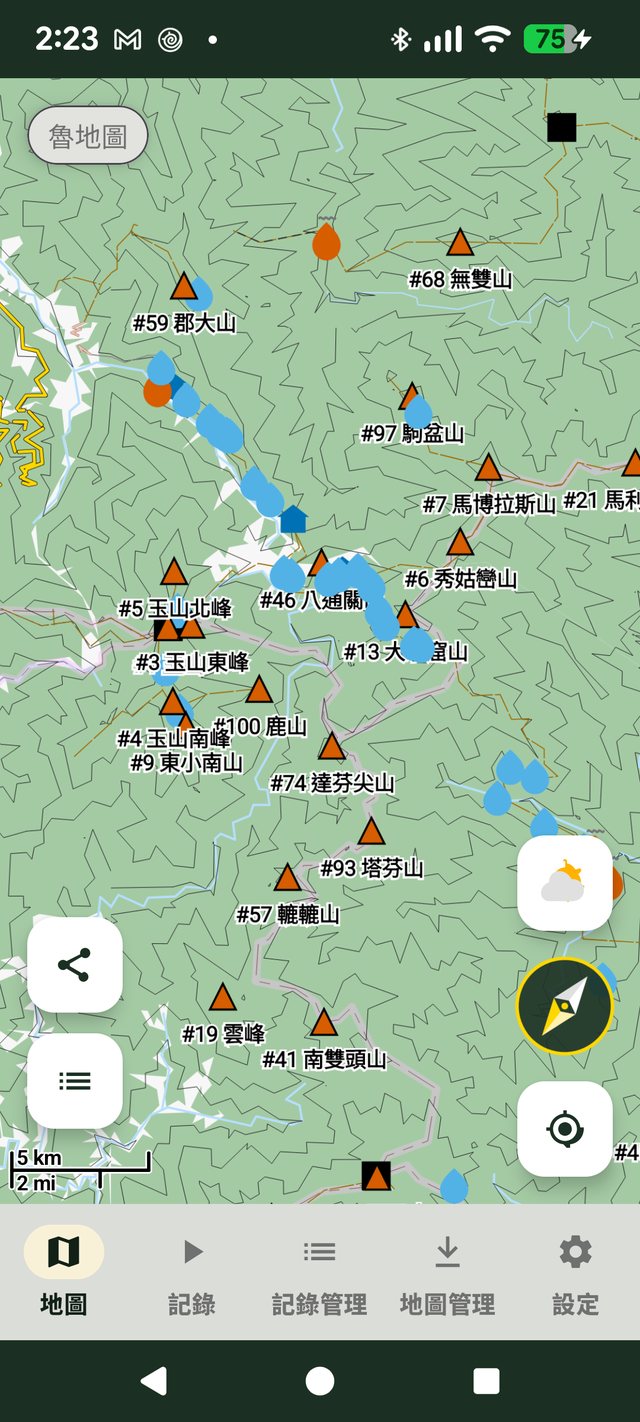
Peaks and triangulation points, even offline
Peak names, four grades of triangulation points and water sources within a 50km radius — never miss a landmark, even with zero signal.
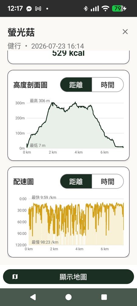
Analysis charts generated automatically
Elevation profile, pace chart and estimated calories burned — understand the intensity of your route at a glance.
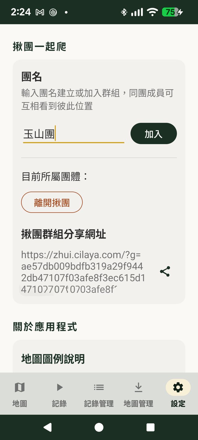
Hike together, see each other's location
Enter a group name to create or join — every member in the group can see each other's live location.
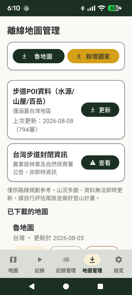
Real "offline" — not a cached screenshot
ZhuiZhui uses the Mapsforge vector map engine to download the complete terrain map to your phone, instead of caching a few screenshots. LuMap for Taiwan, OpenAndroMaps for overseas — download before you go, and it works with zero signal, fully able to pan, zoom and search.
- Thousands of trail data points: peaks, 1st–3rd class triangulation points, benchmarks
- Mountain huts, emergency shelters, springs and man-made wells
- Color-blind-friendly contour lines and trail difficulty rendering
Solo hiking, with peace of mind for your family
Turn on live sharing and your hiking location uploads periodically — share your personal link with family or friends. No install, no sign-in required: they just open the link to see your current position and route. For group trips, everyone can see each other's location too.
- No install, no sign-in — just open the link to view
- Group mode: everyone sees everyone's live location
- Cloud data kept for 90 days only, account self-deletable anytime
Ready to explore the outdoors?
Download ZhuiZhui for free — offline maps, activity tracking and group sharing, all in your pocket.