
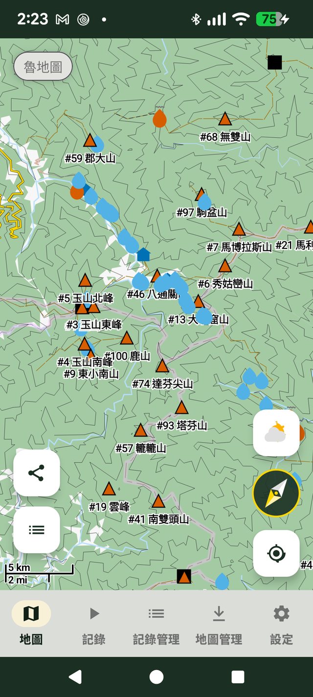
Why "truly offline" matters
Most hiking routes in Taiwan lose signal the moment you enter the mountains — relying on an online map app there is basically flying blind, and a failed connection just shows a blank screen. ZhuiZhui uses the Mapsforge vector map engine to download the complete terrain map file to your phone's storage, instead of caching a few screenshots or depending on online map tiles. That means:
- With zero mobile signal, the map can still zoom, pan and locate you
- More battery-efficient than online tile mode — good for multi-day traverses
- Route planning can be done before you go, even at home
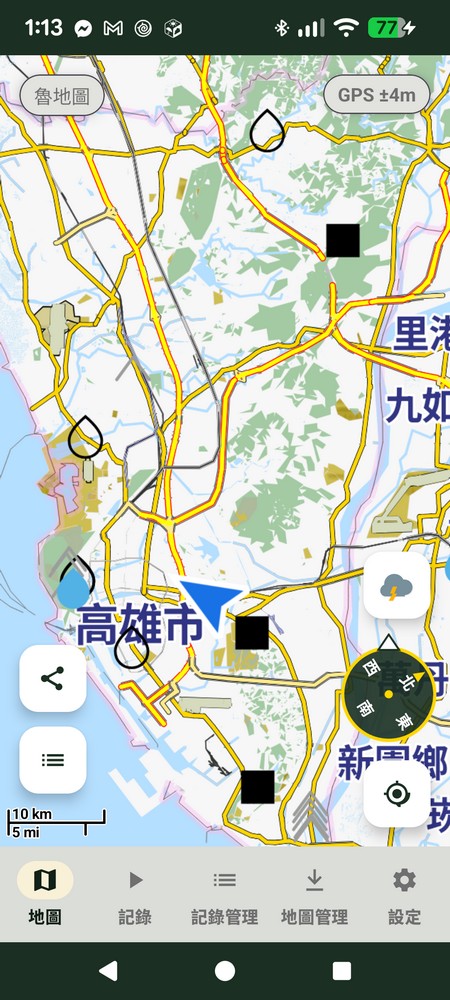
A built-in compass, always know your direction
A compass built right into the map shows your current heading and GPS accuracy in real time, alongside one-tap location sharing and quick access to your activity list — locating, orienting and route-finding all handled in the mountains.
Taiwan's LuMap + overseas OpenAndroMaps
Pick the offline map data for the region you're heading to — downloading, updating and switching all happen on the same management page.
Taiwan: LuMap
Terrain map data maintained long-term by Taiwan's hiking community, with complete contour lines and trail network nodes — the most comprehensive offline data source for planning routes on Taiwan's 100 Peaks and suburban trails.
Overseas: OpenAndroMaps
No need to worry when hiking or trail running abroad — download the map data package for the country/region you need. Japan, Southeast Asia and more all support the same offline navigation experience as Taiwan.

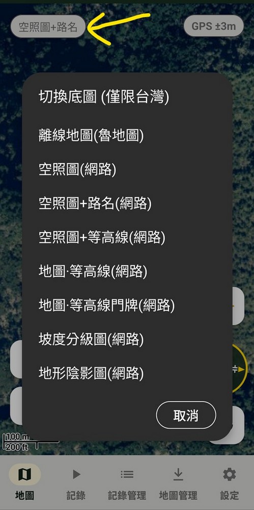
Online basemap layers, richer detail (Taiwan only)
Tap the basemap label in the top-left corner of the map to switch between the offline map (LuMap) and several online basemaps: satellite imagery, satellite + road names, satellite + contours, map + contours, map + contours with address points, slope classification, and hillshade — sourced from Taiwan's National Land Surveying and Mapping Center. Switch to these when you have signal for a more intuitive comparison of terrain and slope detail — a bonus reference beyond the offline map.
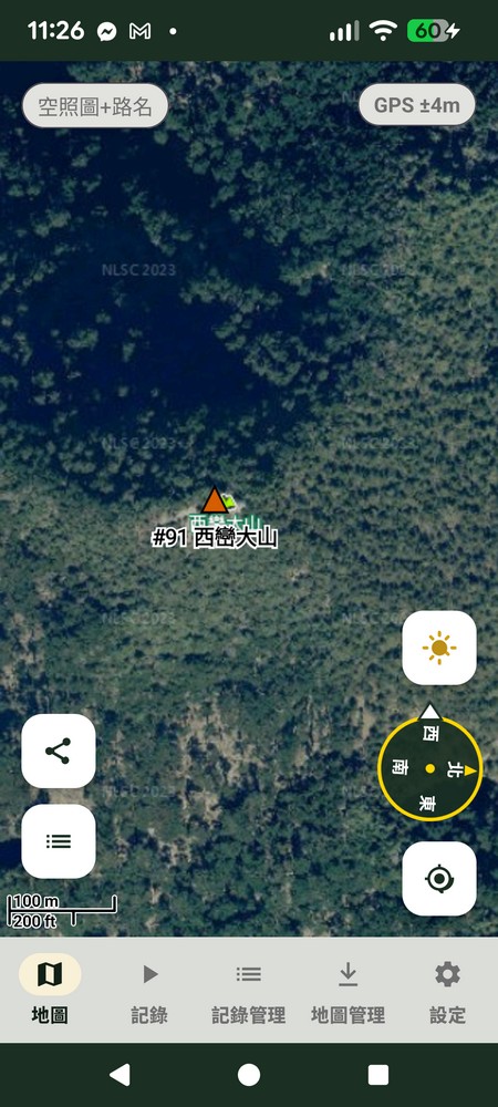
Satellite + Road Names
Satellite imagery overlaid with road names — the most intuitive way to compare terrain and paths on the ground.
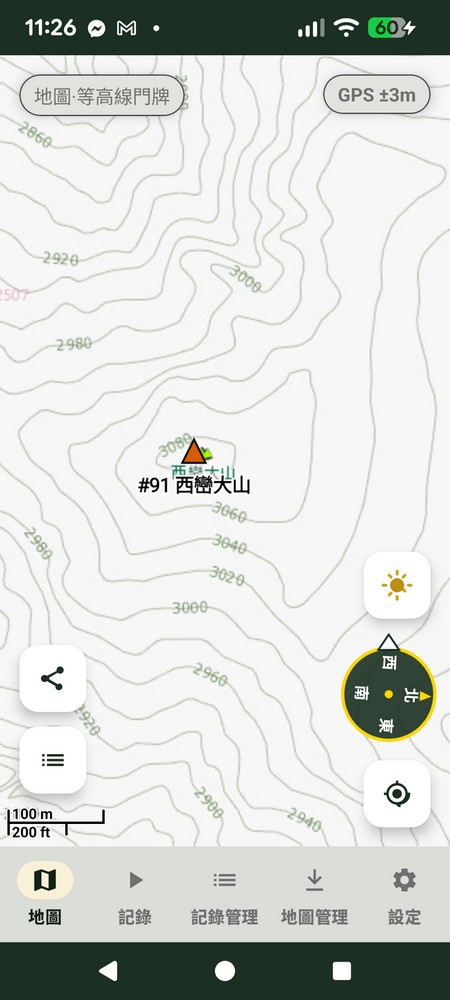
Map · Contours with Addresses
Contour lines overlaid with address points — more precise planning for suburban trails and routes near urban areas.
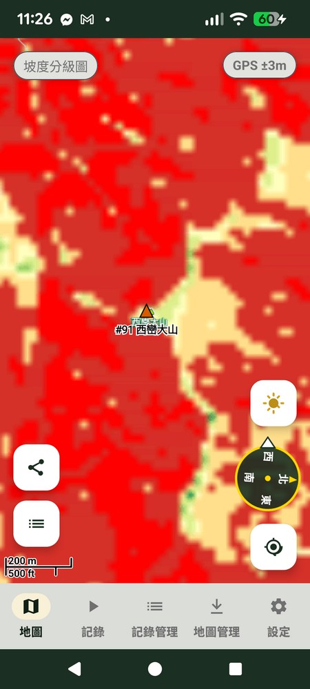
Slope Classification Map
Color depth shows how steep or gentle the terrain is — quickly identify steep sections when planning a route.
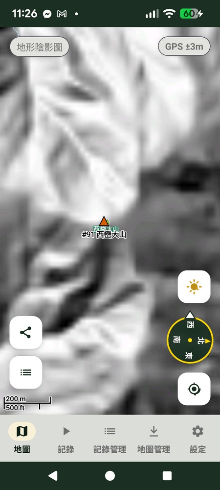
Hillshade Map
Grayscale shading simulates terrain lighting — valleys and ridgelines are clear at a glance.
Peaks, triangulation points, huts and water sources, all marked on the map
This is what sets ZhuiZhui apart from a typical offline map app — it's not just "has a terrain map," it's a database of the trail information Taiwan hikers actually need to look up, queryable even offline.
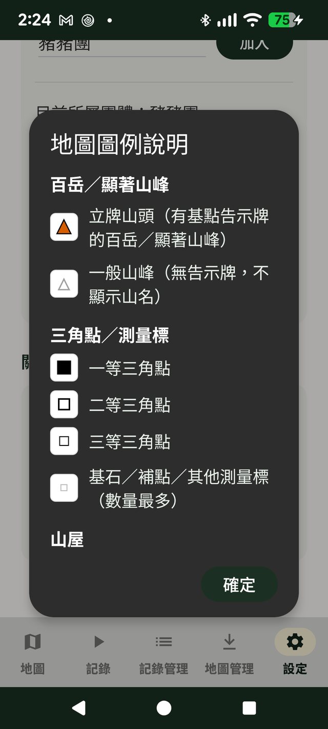
Taiwan's 100 Peaks & notable summits
Compiled from the 1971 list selected by Lin Wen-an and others, with elevation and coordinates individually cross-checked and corrected. Marked peaks show clear name labels, and general peaks show their location too.
Triangulation points / survey markers
1st, 2nd and 3rd class triangulation points along with benchmarks and supplementary markers are all graded and labeled — the most direct reference for judging key landmarks on a route.
Mountain huts & water sources
Staffed huts, unstaffed simple shelters, emergency shelters, as well as springs, hot springs and man-made wells — plan your trip with more confidence.
Signal Points
Marks locations in the mountains where you have a chance of getting phone signal — an important reference for planning rest stops or checking in on deep mountain sections.

Trail Closure Info
Integrates open data from Taiwan's Forestry and Nature Conservation Agency "Trail Status" dataset, compiling closures, partial closures and expected reopening dates for trails across Taiwan into a single list — check it before you go to avoid a wasted trip or wandering into a hazardous section.
How much longer? Two taps and you'll know
Once you've loaded a GPX reference route, ZhuiZhui estimates hiking time along the map's trail network — useful whether you're planning ahead or checking your progress mid-hike.
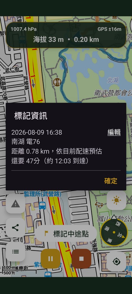
Tap a point mid-recording to see how much longer
Tap a marked point on the map to instantly see the distance, plus an estimate — based on your current pace — of how many minutes left and what time you'll arrive.
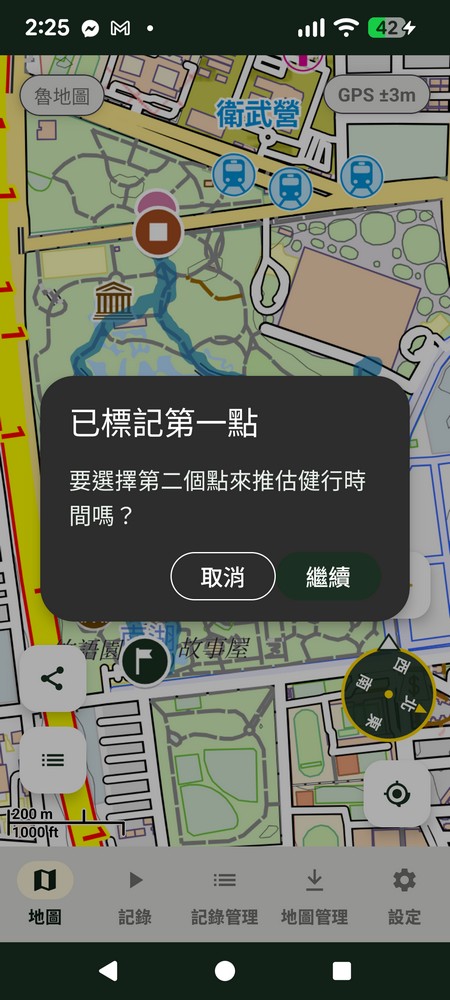
Pick a starting point
Tap anywhere on the map as your starting point, and ZhuiZhui will ask if you want to pick a second point to estimate hiking time.
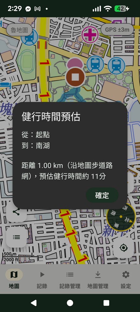
Pick an endpoint, get an instant estimate
Pick a second point and instantly calculate the distance along the map's trail network and an estimated hiking time — no need to actually record a hike to get an estimate first.

LuMap rendering style, switch freely
Prefer LuMap's official style, or ZhuiZhui's own optimized look? Two toggles on the settings page adjust it — this only affects the LuMap basemap itself; overseas map data and the color-blind-friendly legends for peaks, triangulation points and other POIs on the map are unaffected.
- LuMap uses LuMap contours: on uses LuMap's official contour style, off switches to ZhuiZhui's own hand-tuned contours
- LuMap official full style: on switches roads, buildings and icons entirely to LuMap's official style; off uses ZhuiZhui's own style (larger, easier-to-read text) — this option overrides the contour setting above
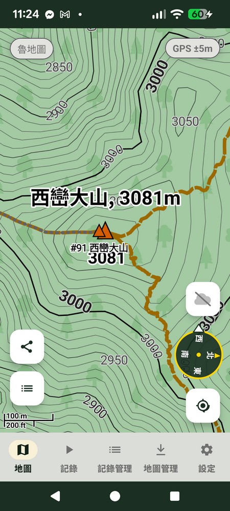
ZhuiZhui StyleLarger text, peak names clear at a glance
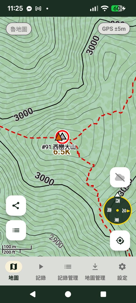
LuMap Official StyleRoads, buildings and icons entirely in the official style
Every symbol is designed to be color-blind-friendly
Peaks, triangulation points, huts, water sources and trail safety markers on the map all use the Okabe-Ito color-blind-friendly palette along with distinguishable shapes, never relying on color alone to convey key information. Below are the symbol rules actually used in the Taiwan LuMap data.
Peaks / Notable Summits
Triangulation Points / Survey Markers (4 grades)
Mountain Huts
Water Sources
Signal Points
Trail Difficulty & Visibility
Trail Nodes & Safety Features
Download offline maps, be ready before you go
Taiwan's LuMap, overseas map data, and the trail POI database — all free to download.