
When planning a trip, it's common to end up with a track file someone else shared — maybe a GPX a fellow hiker sent you, or a KML route you drew yourself in Google My Maps. This guide explains how to import an existing track file like that into ZhuiZhui, so you can overlay it against the route you actually walk.
What are GPX, KML and KMZ
GPX (GPS Exchange Format) is an open GPS track exchange format supported for reading and writing by nearly every hiking and running app — the most universal track file format out there. KML is the format used by Google Earth / Google My Maps, and KMZ is a compressed version of KML — essentially the same underlying data. ZhuiZhui supports importing all three formats directly.
Import steps
- Open ZhuiZhui and tap the "Activity Management" tab in the bottom navigation bar.
- Tap the "Import Track" button near the top of the page — this opens your phone's system file picker.
- Choose the .gpx, .kml or .kmz file you want to import (it doesn't matter whether the file is stored locally on your phone, in a cloud drive, or downloaded from a LINE/email attachment).
- Once imported, the route appears directly in your activity list, just like a track you recorded yourself.
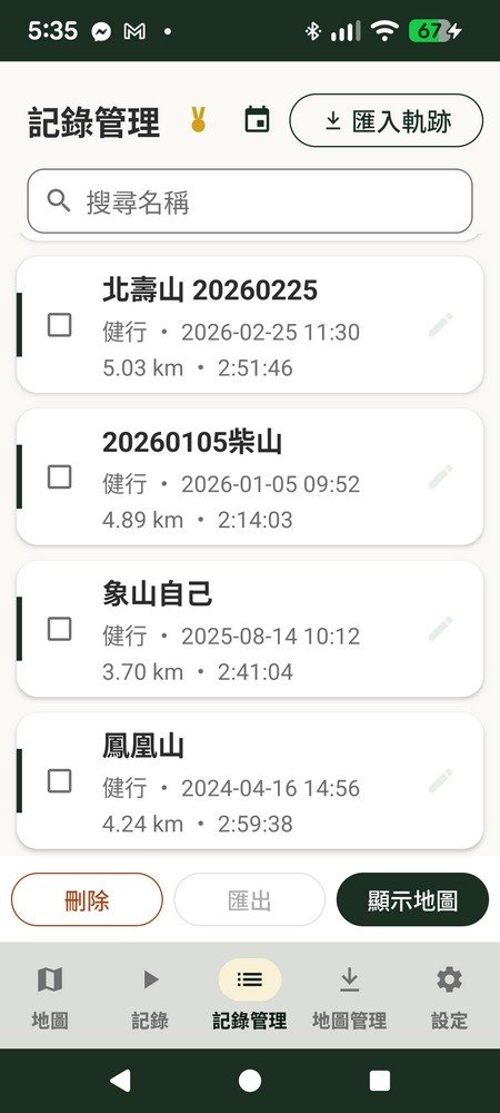
What you can do after importing
- Show the full route on the map to get familiar with the path before you go
- Overlay it as a "reference route" to check in real time during a hike whether you've strayed off trail
- Distance and elevation gain/loss are recalculated from the imported coordinate points, not simply carried over as-is
- Rename, delete or export it just like a route you recorded yourself
Common gotcha: KML exported from Google My Maps may have no timestamps
If your track file is a KML/KMZ exported from Google My Maps, there's a real-world quirk to watch for: files like this often contain only coordinate points, with no time field at all. In that case, the "creation date" for that record has no real data to draw from, so ZhuiZhui falls back to the file's own last-modified time as a reference — this isn't a bug in ZhuiZhui's import feature, it's simply that the original file never had this information, and you'd hit the same limitation importing it into any other app. If you need precise timing, we recommend using a GPX file with real recorded timestamps instead.
Going the other way: export your ZhuiZhui records as GPX
Every run and hike you record in ZhuiZhui can be exported as a standard GPX file, with a filename built from your record's name plus the date so it's easy to identify. Once exported, bring it to a tool like gpx.studio for further track merging and editing, share it with fellow hikers, or upload it to another platform — your data is entirely yours, never locked into a single app.
If you haven't downloaded the offline map for this trip yet, check this out first: How to Download Offline Maps on Your Phone: Hiking Trip Prep Guide.